TRINA PERSAD
COMMUNITY PARK
Multigenerational Pocket Park in Roxbury, Massachusetts
The Trina Persad Community Park is a design response to the Dudley neighborhood community through a highly interactive participatory process, during which concepts were generated for initial development by GDIRC for feedback by the community.
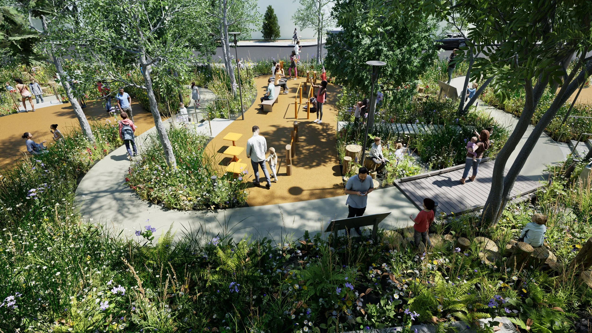
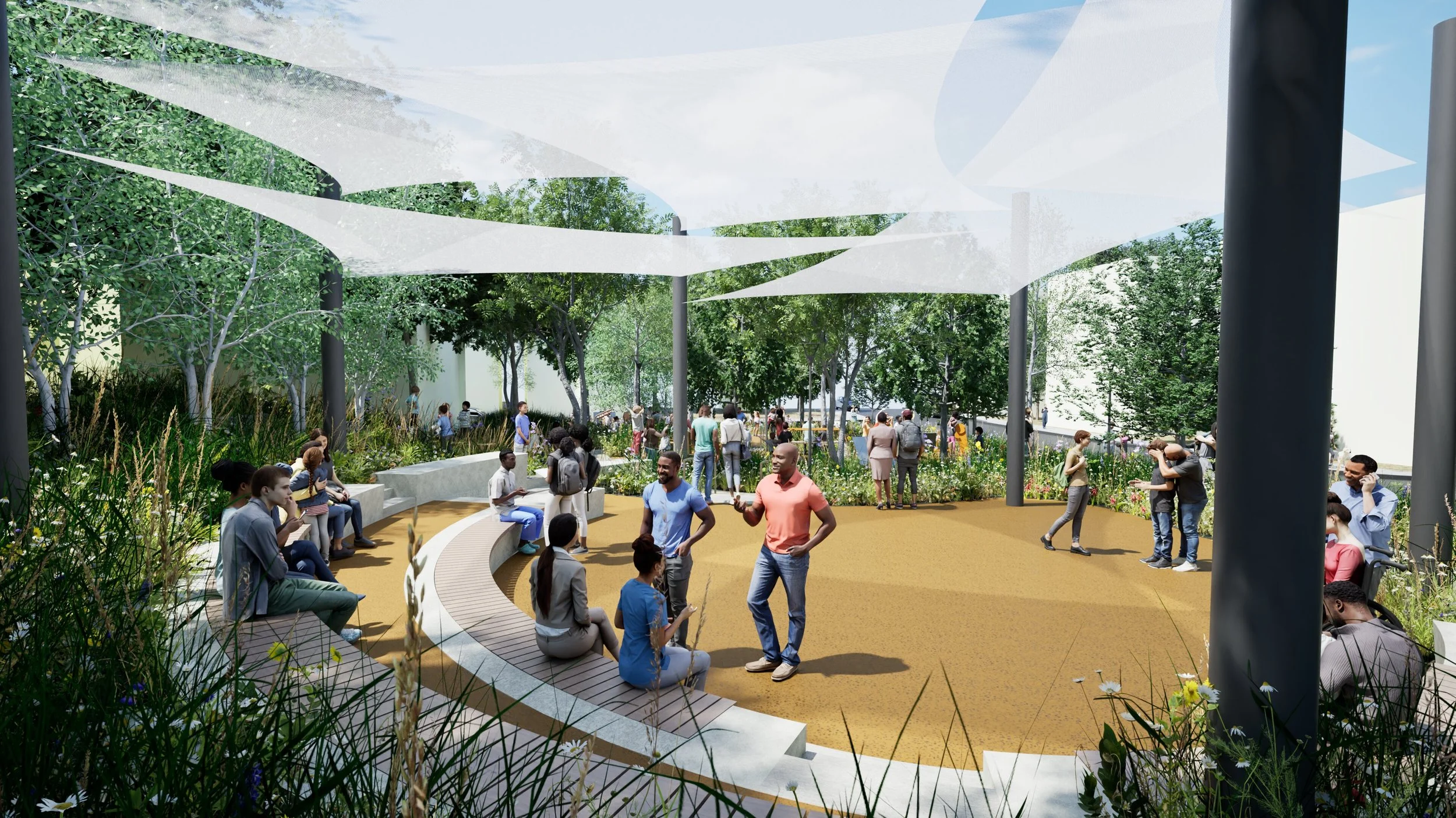
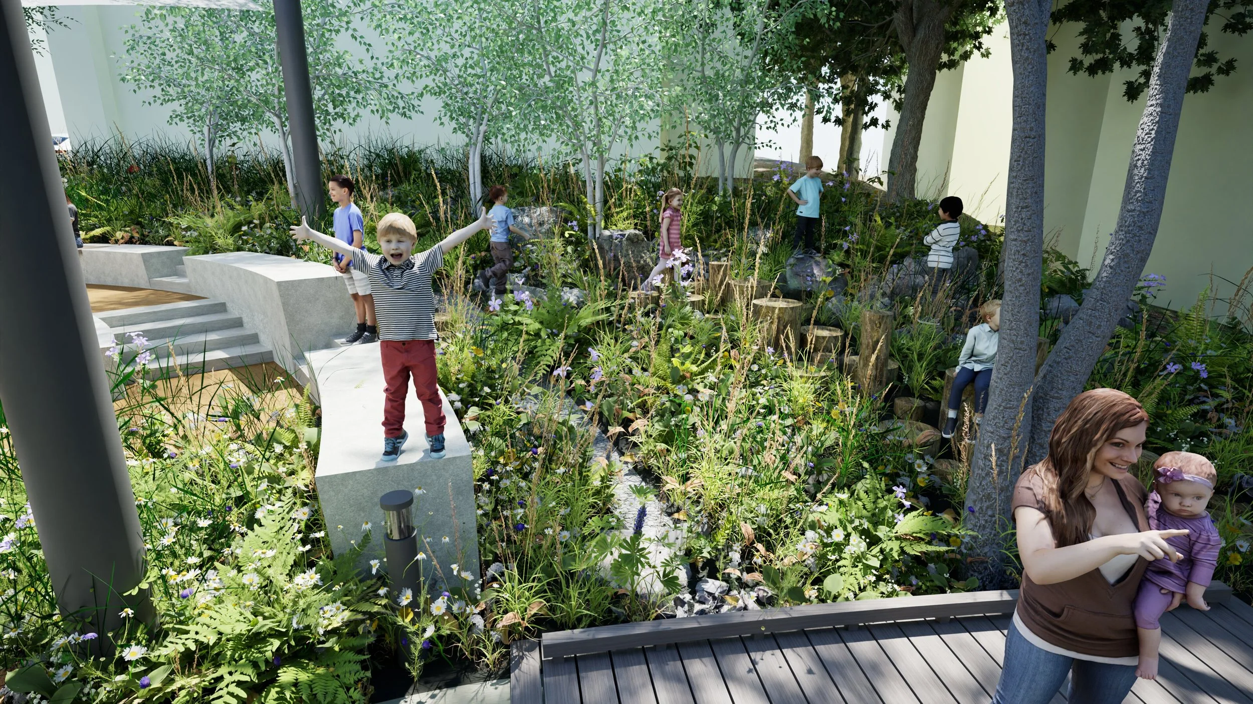
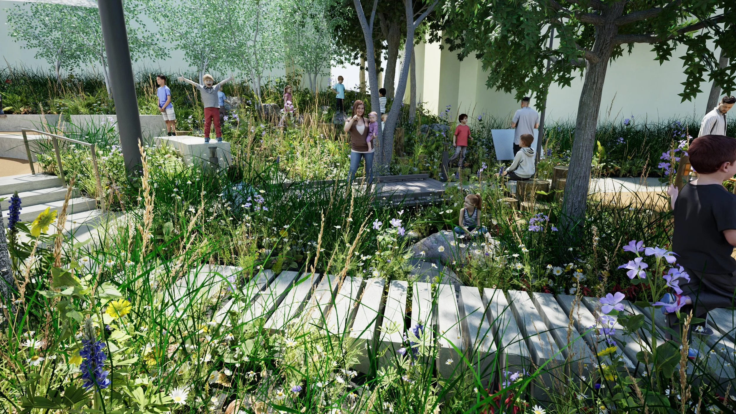
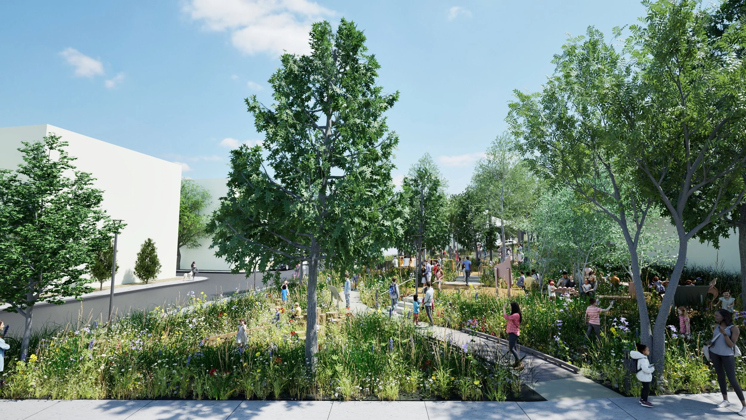
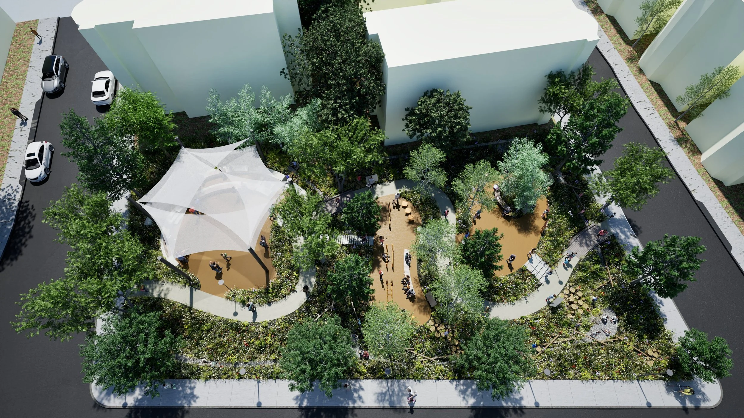
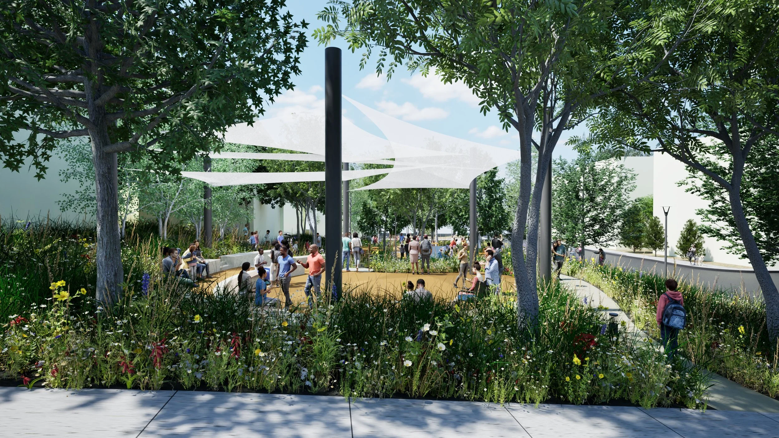
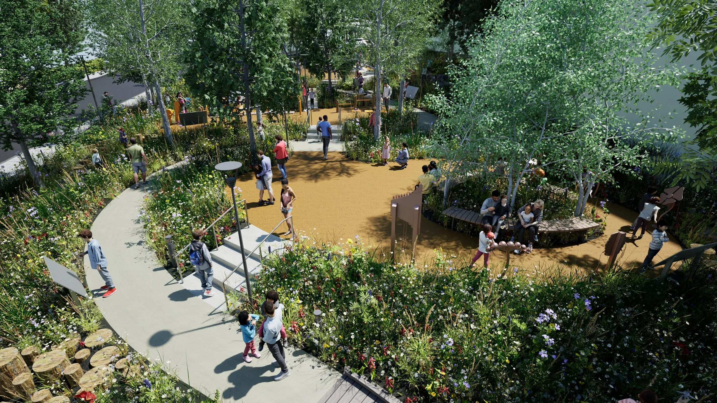
Designed for the benefit of all generations in the community, the park includes versatile shaded gathering spaces that lend themselves to a range of activities. The resilient landscape will contribute to restore the local ecology and provide habitat for native species while the meandering walk through the park will offer much needed respite from the surrounding urban fabric and will memorialize Trina Persad’s tragic loss of life to gun violence
Timeline: 2024-(Ongoing)
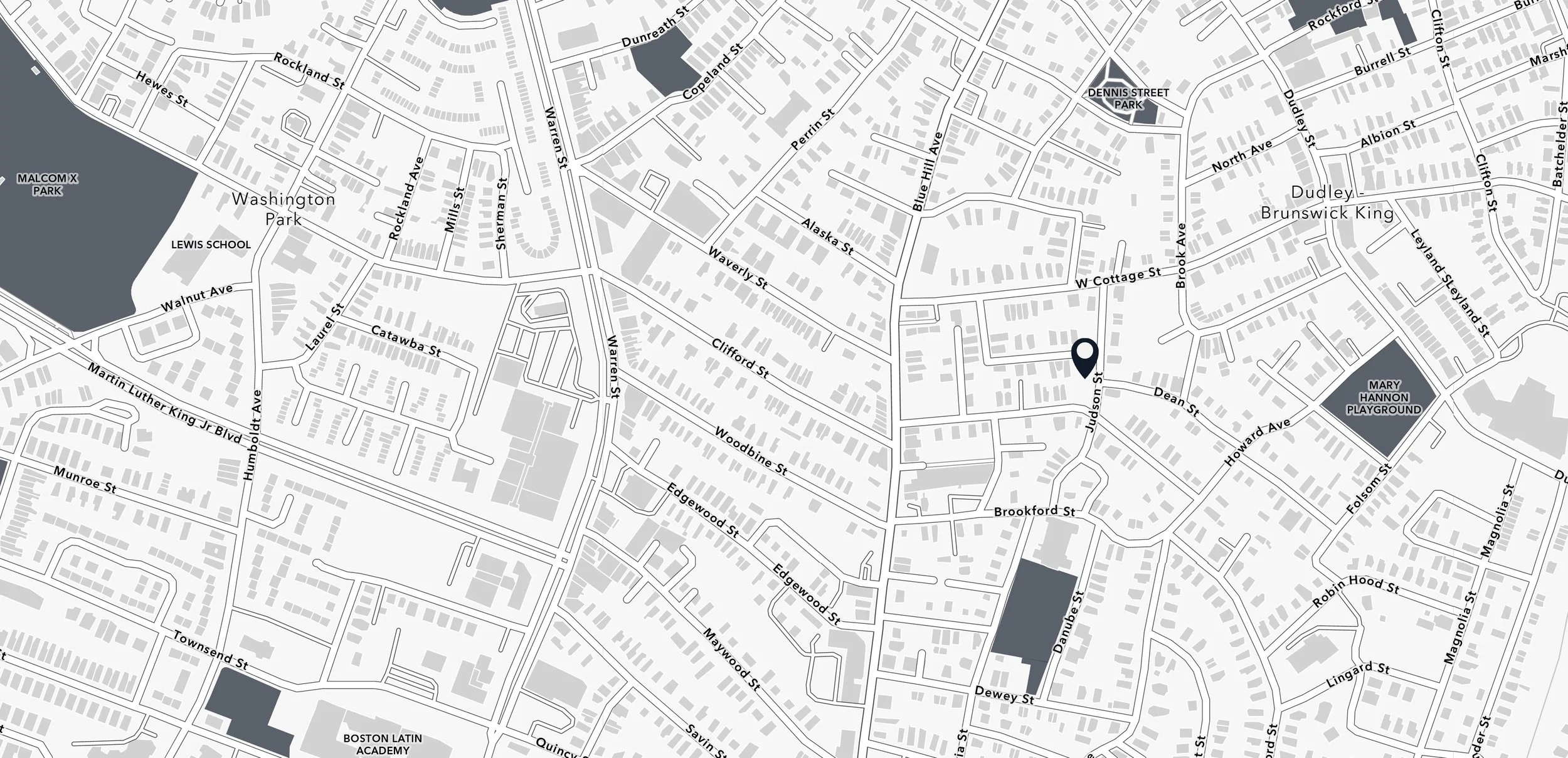
Location: 14-16 Judson St, Boston, MA 02125
Size: 11,000 Square Feet
Partner: Dudley Neighbors Inc. (DNI) & Dudley Street Neighborhood Initiative (DSNI)
Key Team Members: Shirine Boulos Anderson, Adrian Fehrmann, Amanda Leifer, Malda Takiedine, Veronica Mansilla, Salma Nour, Owen Wallenberg, Carrie Brooks, Chrisoula Moraitis
Benefits to the Community
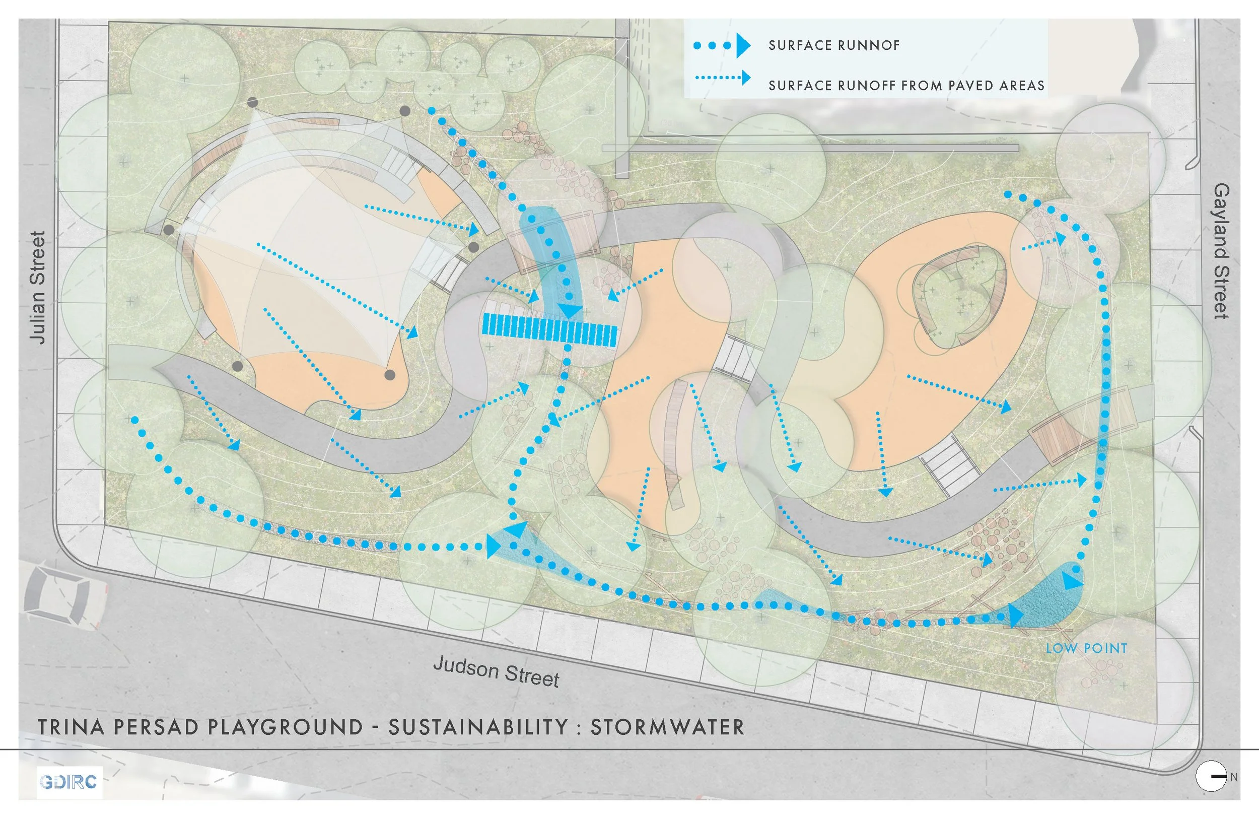
The outdoor space is designed for the benefit of all generations in the community and includes versatile shaded gathering spaces that lend themselves to musical or other performances, family gatherings, free play [skip rope, tricycle, run] and immersive exploration [balance beams, educational identification of native flora and fauna], as well as use of multi-generational outdoor fitness equipment. The resilient landscape, designed to manage stormwater run-off through infiltration in retention ponds arranged as "dry rivers", also serves for children's play and discovery. These will contribute to restore the local ecology and provide habitat for native species. The highly versatile environment offers a haven to the community as increasingly high-temperature-days are anticipated going forward.

Site
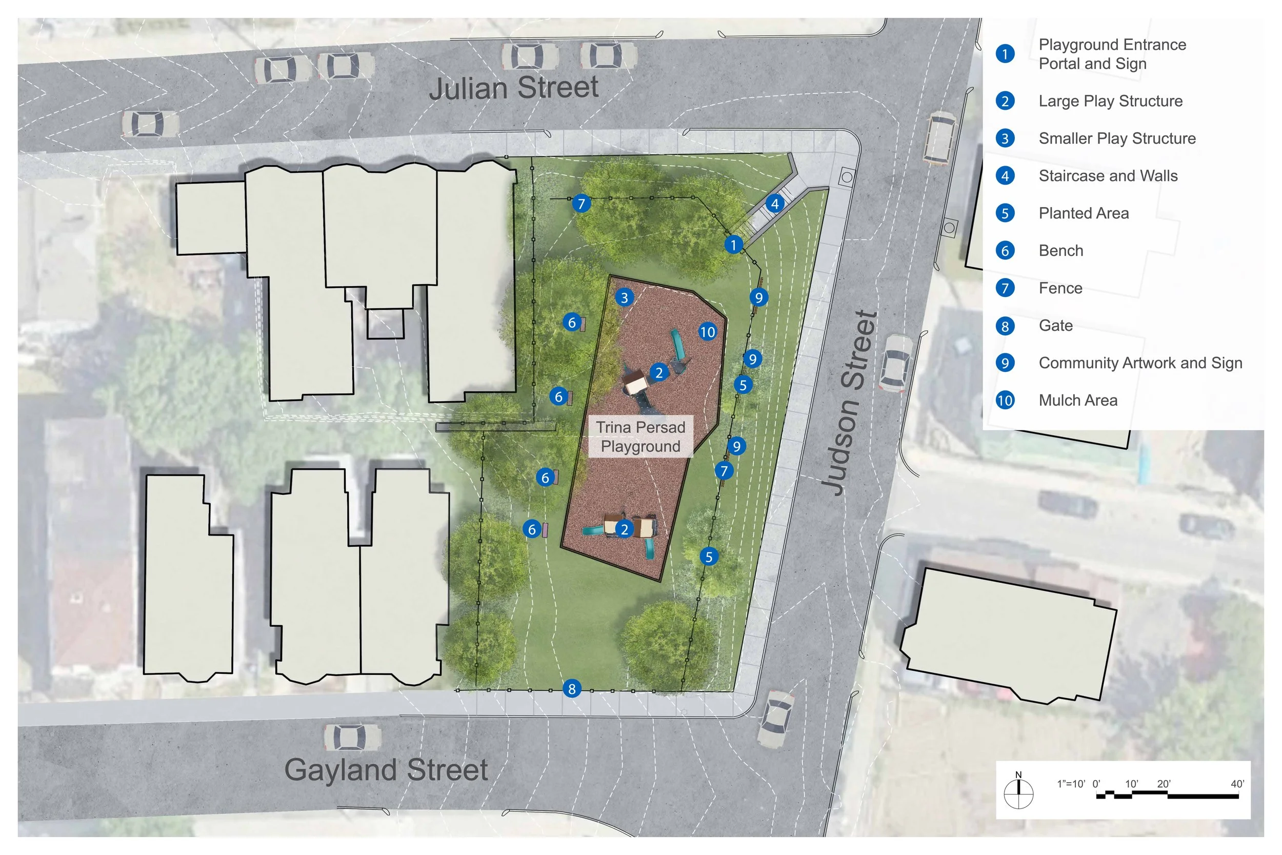
The existing site is an underutilized playground, and is the site of 10-year-old Trina Persad’s tragic loss of life to gun violence in 2002. Outdated and damaged play equipment, invasive species trees and fencing will be removed to make way for a Community Park, universally accessible to the public daily between dawn and dusk.
Design Process
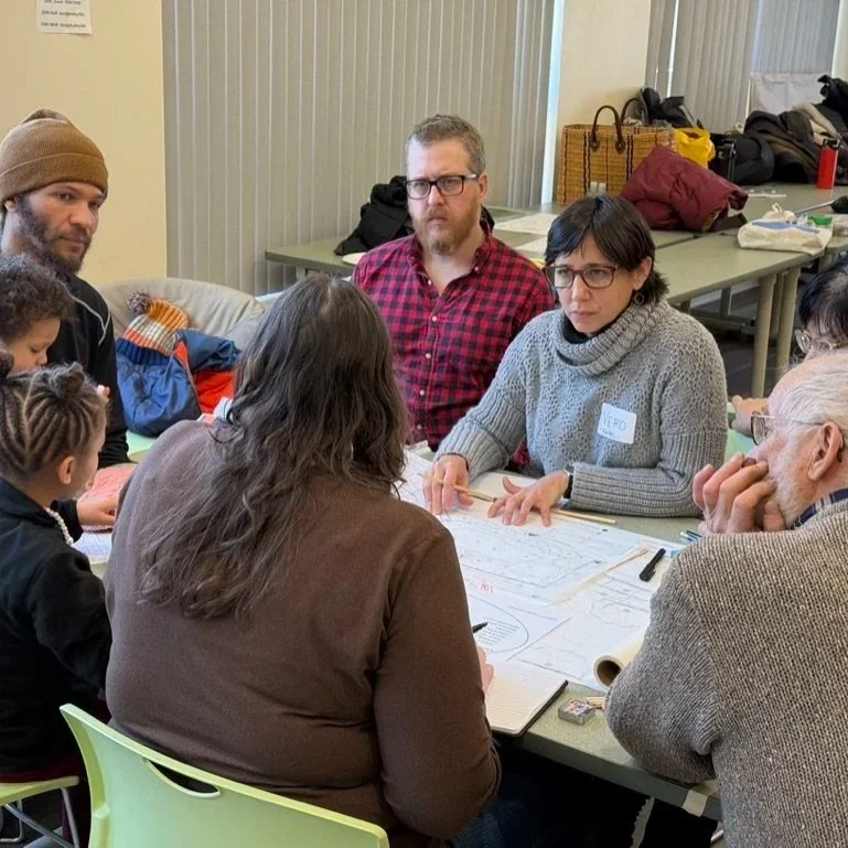
In Fall 2024, GDIRC embarked on a partnership with Dudley Street Neighborhood Initiative (DSNI) and Dudley Neighbors Incorporated (DNI) to reimagine a children’s play space on the existing site. As our goal was to generate a responsive design solution that reflected the community’s wishes, we proposed a design process that was participatory, inclusive, immersive and dynamic. Over the months of September 2024 through May 2025, DSNI and GDIRC held a series of participatory design Community Engagement sessions, to identify what resonated with various age groups of the community.
Community Engagement
In Fall 2024, Participatory Design sessions explored themes such as Play in the Context of Child Development, where examples of unstructured play, goal-oriented play, child-directed play, and playful learning landscapes were shared and discussed. GDIRC then organized a tour of three existing playgrounds with different characters, followed by an interactive session where community participants identified their likes and dislikes. The most salient comments were in favor of the integration of landscape features and seating with creative play elements. GDIRC summarized the goals for the Trina Persad Park as inclusive, safe, resilient, and educational.

Design Workshop
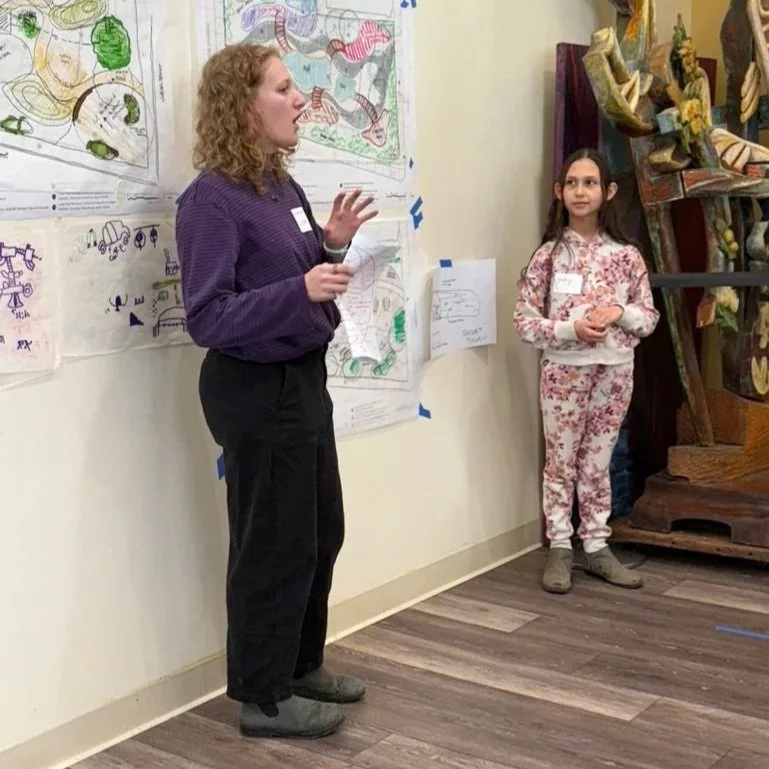
In January 2025, we organized a Workshop with three GDIRC team leaders and participants –including from the broader Architecture and Landscape Architecture community– and invited community members of all generations to join a team and voice ideas about what might be envisioned in the park. A blank site plan served as a basis to generate concepts using drawing materials, sticky notes, and colored markers and pencils.
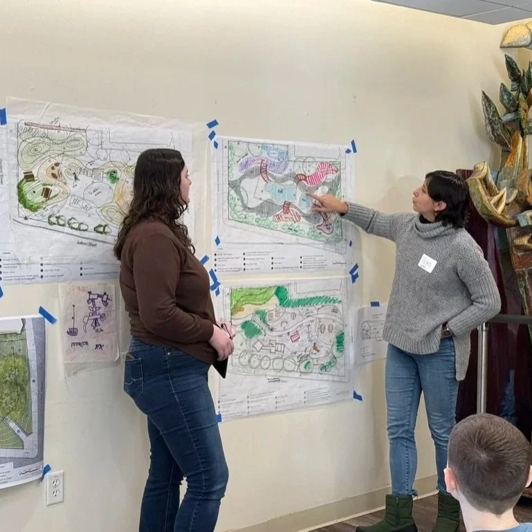
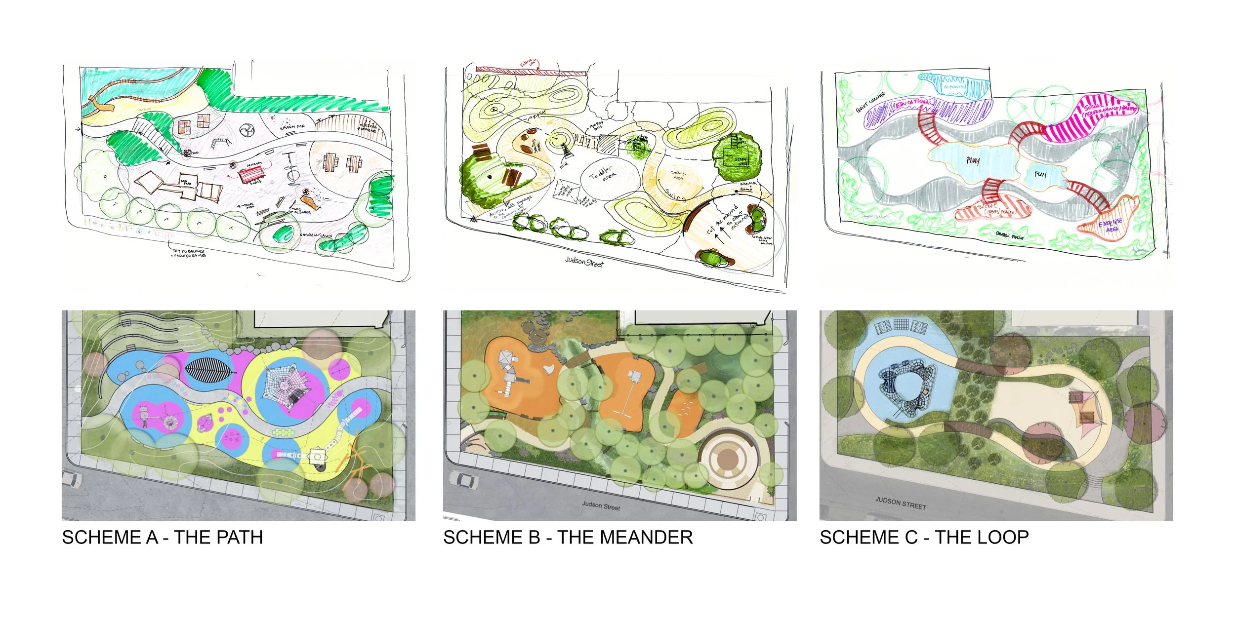
During the last hour of the Workshop, three concepts, diagrammed below, were presented to all the participants, each with its unique character:
A. The Path, connecting Julian and Gayland streets, is flanked with play activities and equipment, while the edges of the site show stepped seating, shade trees and a resilient landscape.
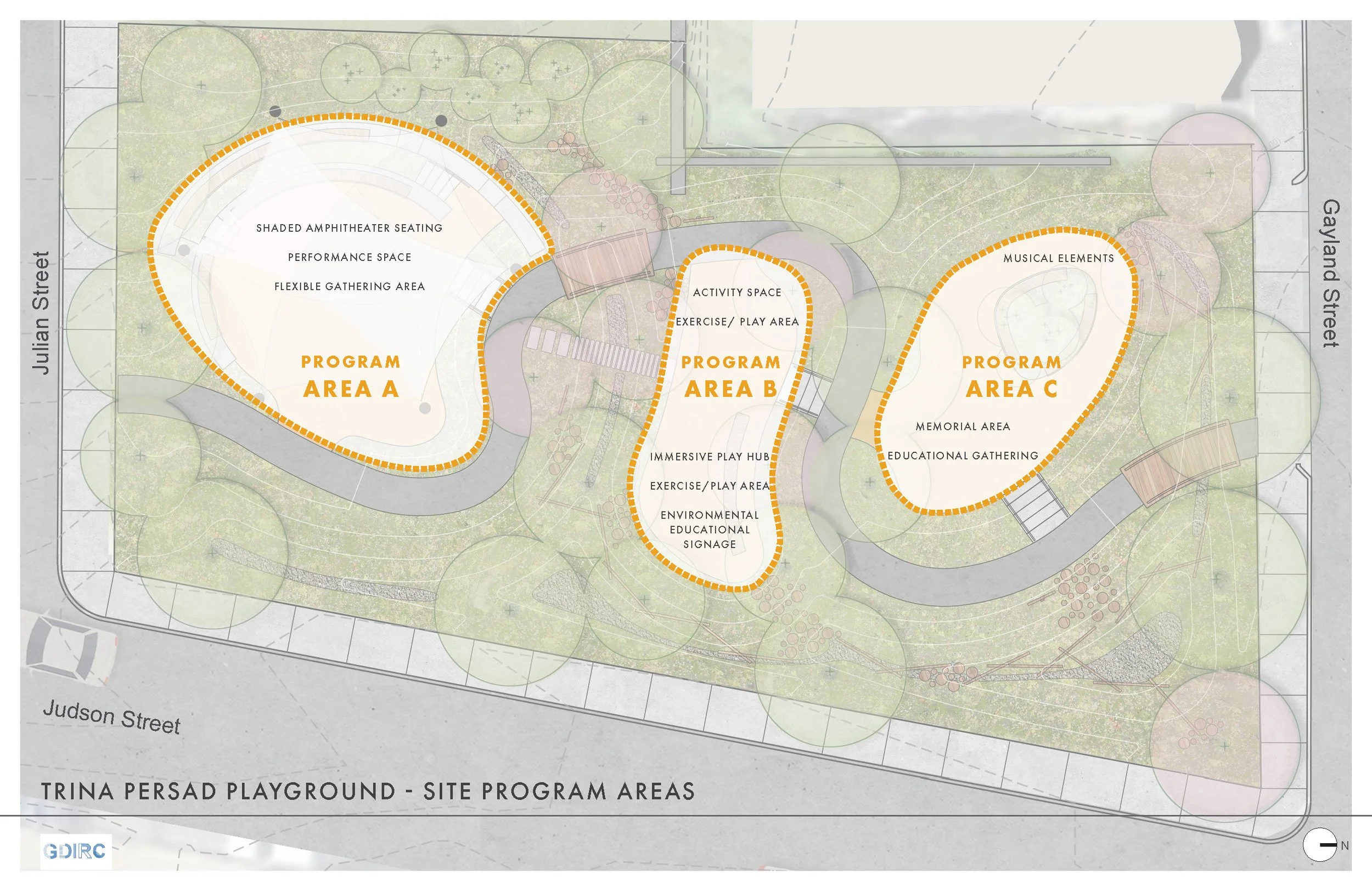
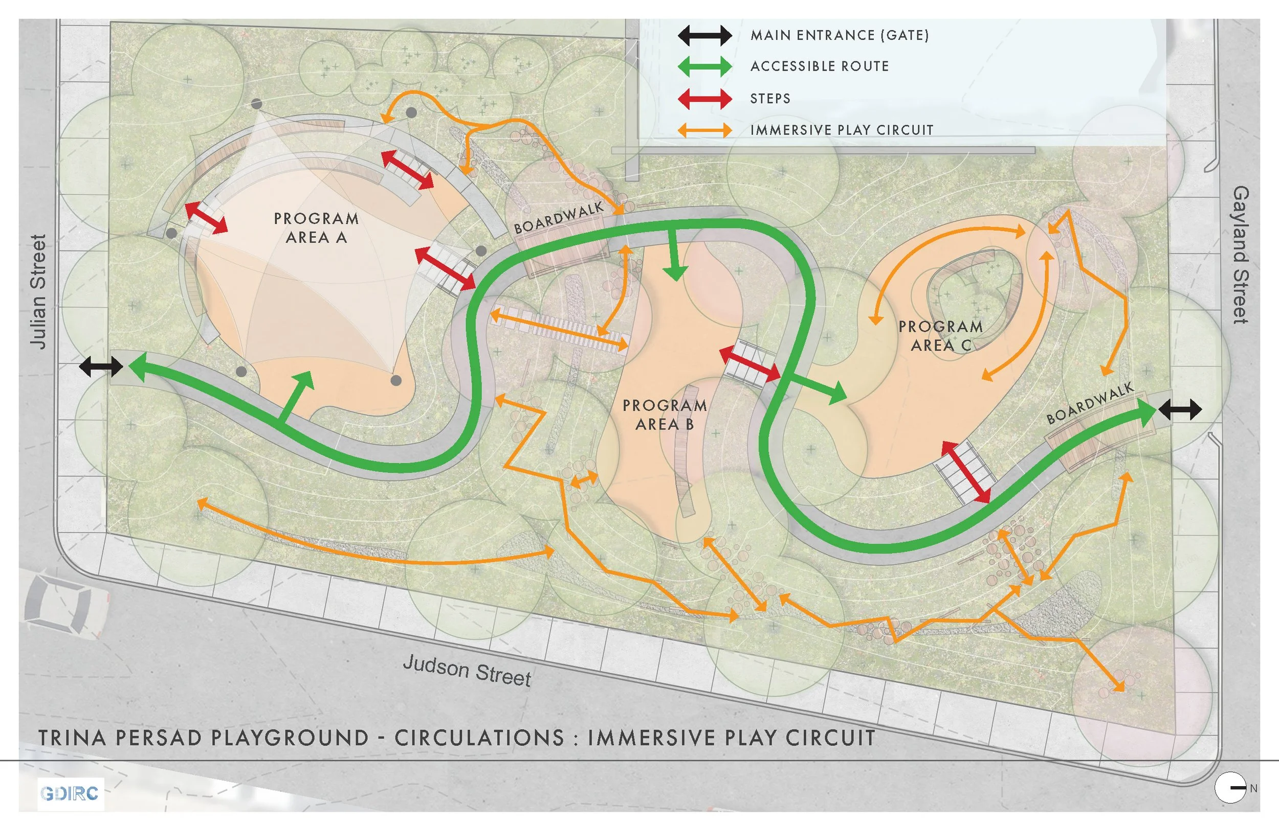
B. The Meander also connects Julian and Gayland streets, though the accessible route meanders creating distinct pockets of activity, and integrating a bolder resilient landscape throughout the site.
C. The Loop, shows a looped accessible path with two distinct areas of activity, connecting to a resilient landscape around its perimeter.
Final Community Engagement
The three concepts were further developed and rendered by the GDIRC workshop team participants during the following months. We presented these to the community in April 2025 for feedback, with the goal of selecting a preferred scheme to continue developing, which would serve as the final Concept Design. While The Meander emerged as the preferred scheme as it integrated a resilient landscape and shade trees more effectively than the other schemes, we learned that a playground was not what the community wanted. Indeed, as there are two existing playgrounds within walking distance of the site, a multigenerational space incorporating different activity zones resonated well with everyone.
The preferred scheme was further developed and presented to DSNI, DNI and the Community in August 2025, and was submitted to the City of Boston’s Community Preservation Office (CPA) as part of a Funding Eligibility application. In October 2025, the CPA determined that the project is eligible for City funding, and DNI is currently in the process of applying for funding by the CPA and other foundations for the implementation of the project.